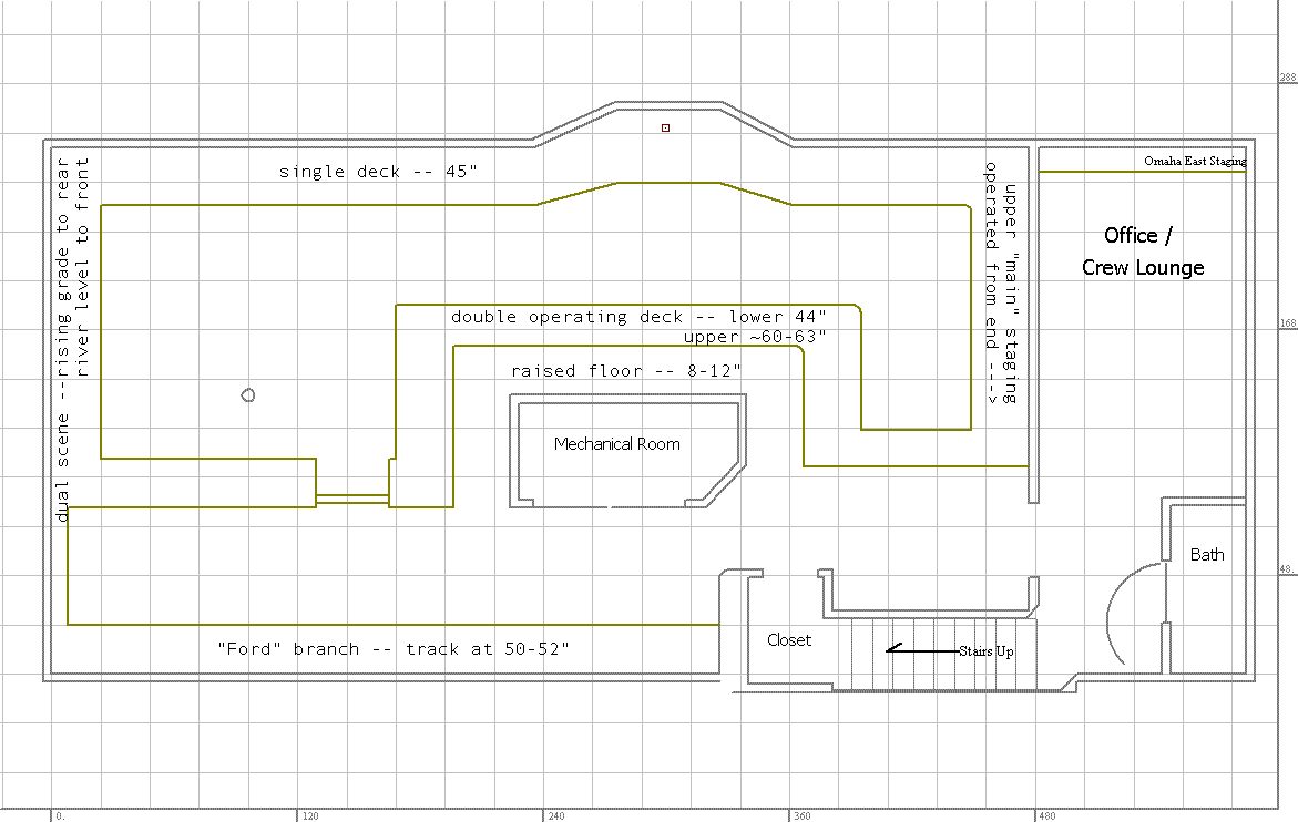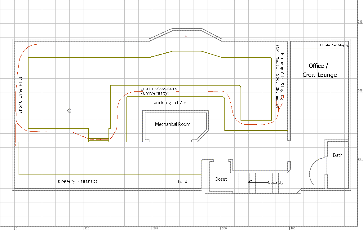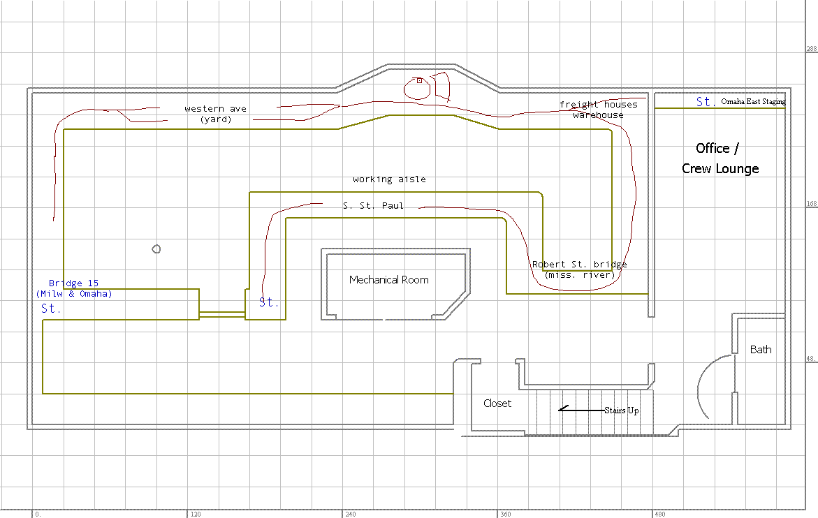
What I'm working with right now looks something like the drawings below. Before I go any further, I'd like to state my utter frustration at the lack of useful tools to do any sort of online track plan sketching. I have a bunch of this stuff on paper sketches, and will get some of those online once I get the chance to scan them. But until then, I have the following.

Notable in this plan is the multi-level middle peninsula. This is a partial mushroom, as each level is operated from a different side. The narrow aisle around the mechanical room is deliberate. I don't have a lot of room for a generous aisle, and there is a perfectly good alternate route, although it will involve stepping away from the train for a bit. I've done some ergonomic tests with local operators, and most have found that a 24" aisle with a fairly high track level works just fine. I'll extend the test soon to be a more likely representation of the final plan, and re-run the tests.
The single deck section represents the Mississippi river bottoms around downtown St. Paul (mostly upstream of downtown), as well as the flats of the West Side (which is south of downtown) and South St. Paul.
The dual scene section to the left on the drawing has "Short Line Hill", which is a short, steep grade on the Milwaukee Road. This was, as I understand, the ruling grade on the Milwaukee between Chicago and Tacoma. Partway up the hill is Fordson Junction, where the longish branch over to the Ford plant begins.
An example train will depart Minneapolis staging, heading clockwise around the plan. We pick this train up from the end of staging, by the entrance to the train room. We then head through the elevator district, over the duckunder bridge (at about 62"), and down Short Line Hill, and back along the long wall at the top of the drawing. We'll stop to work in the yard, just to the left of the bay windows, and then head out again, clockwise once more, and around the corner. This take us across the Robert St. bridge and into S. St. Paul, and Rock Island/CGW staging.
Partway around the corner, just before the bridge, is another line, which ducks out of view fairly quickly, and heads down the same peninsula (onto a third level). This track is no more than 8-10" below the track level of S. St. Paul, and this is east staging (Milwaukee Pig's Eye Yard, CB&Q Hoffman Yard)
Apology time again: I really am not thrilled with these rough drawings, mostly because my online drawing tools are not so good. As I firm up the plans, and take the time to do something CADish (which is how I got the main drawing), I'll get much better plans online.
Additional staging tracks are added for C,St.P, M & O (Omaha Road, future C&NW), one set heading into the office on a shelf, and the other to the west of Western Ave. yard on the river level.
A track or two are part of the elevator district for interchange with the Minnesota Transfer.


By the time I had all of this committed to bits, I've been thinking about straightening out the middle peninsula, and moving the "open space" to the other side of this peninsula. With this being straighter, I can get in more useful switching areas (fewer curves) and make it easier to get into east staging (a 1-3 turn helix had been expected, but now I can probably do it with a regular grade). I'll work on getting these sketches online soon.
Please, PLEASE, tell me what you think.